London Bridge station
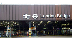 Bus station forecourt in 2003 |
|
 London Bridge
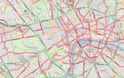
Location of London Bridge in Central London |
|
| Location | Southwark |
|---|---|
| Local authority | London Borough of Southwark |
| Managed by | Network Rail |
| Station code | LBG |
| Platforms in use | 15 |
| Accessible | |
| Fare zone | 1 |
|
|
|
| National Rail annual entry and exit | |
| 2004/5 | |
| 2005/6 | |
| 2006/7 | |
| 2007/8 | |
| 2008/9 | |
| - interchange | |
|
|
|
| 14 December 1836 | Opened |
|
|
|
| List of stations | Underground · National Rail |
| External links | Departures • Layout |
| Facilities • Buses | |
London Bridge railway station is a central London terminal and London Underground station in the London Borough of Southwark, which occupies a large area on two levels immediately south-east of London Bridge and 1.6 miles (2.6 km) east of Charing Cross. It is one of the oldest railway stations in the world. In terms of passenger arrivals and departures is the fourth busiest rail terminal in London, but the statistics do not take into account the large number of commuters who transfer between lines at the station.
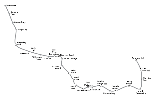
The mainline station is one of 18 railway stations managed by Network Rail and is a major transport terminus and interchange for south London. It serves over 54 million people a year. The tube station serves the Jubilee Line and the Bank branch of the Northern Line. It consists of a ticket hall and entrance area with its main frontage on Tooley Street, along with entrances and exits on Borough High Street. All platforms are accessed through ticket barriers.
The station is in Travelcard Zone 1. London Bridge is one of two rail termini in London located south of the River Thames, the other being Waterloo. For this reason neither have a direct connection to the Circle Line.
Contents |
History
London Bridge Station in Tooley Street, south of the river Thames, is the oldest of the London railway termini, and has had a most complex history involving frequent rebuilding and changes of ownership. (It was not however the earliest stations in the present London metropolitan area, the London and Greenwich Railway stations at Spa Road (Bermondsey) and Deptford opened on 8 February 1836, whereas the opening of the line into the London Bridge Station was postponed until 14 December 1836 due to delays in the completion of a bridge at Bermondsey Street.) From September 1836 trains operated as far as the east end of Bermondsey Street bridge and passengers walked for the last hundred or so yards.[3]
Original London and Greenwich Railway station
The original station was built with a wooden trussed pitched roof, 56 ft by 212 ft (17m by 65m), shortly after opening. However, prior to its completion, the London and Greenwich Railway entered into an agreement with the proposed London and Croydon Railway for the latter to use its tracks from Corbett's Lane Bermondsey and to share its station. The Greenwich railway had however underestimated the cost of building the long viaduct leading to London Bridge and was not able to build a sufficiently large station for the traffic for both companies, and so in July 1836 it sold some land adjacent to its station (then still under construction) to the Croydon railway to build their own independent station.[4]
London and Croydon Railway station

The London and Brighton Railway and the South Eastern Railway (UK) (SER) were also then planning routes from London to Brighton and Dover respectively, and the British Parliament decided that the London and Greenwich line should become the entry corridor into London from South East England. Thus these two railways were required to share the route of the London and Croydon Railway from near Norwood, (which in turn shared the route of the London and Greenwich Railway from Bermondsey in to London Bridge). As a result, in 1838 the London and Croydon Railway obtained powers to enlarge the station it was then constructing at London Bridge, even before it had opened for traffic.[5]
The London and Croydon Railway opened its line and began using its station on 5 June 1839, the London and Brighton Railway joined it in July 1841, followed by the South Eastern Railway in December 1842. Fairly quickly it was found that the viaduct approaching London Bridge would be inadequate to deal with the traffic generated by four railways and so between 1840 and 1842 the Greenwich railway widened it, doubling the number of tracks to four. The new lines, intended for the Croydon, Brighton and South Eastern trains, were situated on the south side of the existing Greenwich line, whereas their station was to the north of the London Bridge site, giving rise to an awkward and potentially dangerous crossing of one another's lines. The directors of the companies involved therefore decided to exchange the station sites. The London and Greenwich Railway would take over the newly completed London and Croydon Railway station, whilst a new joint committee of the Croydon, Brighton and South Eastern companies would demolish the first station and build a new joint station on its site.[6].
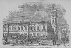
Joint Station
Plans for a large new station were drawn up and drawings were published in the Illustrated London News and George Bradshaw's Guide to the London and Brighton Railway 1844. They show 'a quasi-Italiane building building with a picturesque campanile'[7]. It opened for business in July 1844 whilst only partially complete, but events were taking place which would mean that the bell tower would never be built, and the new building would only last for five years.[8]
During 1843 the South Eastern, and the Croydon railway companies became increasingly concerned by the high tolls charged by the London and Greenwich Railway for the use of the station approaches, and gained Parliamentary approval to build their own independent line into south London to a new station at Bricklayer's Arms. This line opened in 1844 and most of the services from these two companies were withdrawn from London Bridge, leaving only the Greenwich and Brighton companies using London Bridge station. The Greenwich company, which was in financial difficulties beforehand, was on the brink of bankruptcy and so was forced to lease its lines to the South Eastern Railway, which took effect from January 1845. The following year the Croydon and Brighton companies merged with others to form the London Brighton and South Coast Railway (LB&SCR). As a result of these amalgamations there were now only two companies wishing to use the two adjoining stations at London Bridge. As a result the LB&SCR used the unfinished joint Station until 1849 when it was demolished to make way for an enlarged station.
South Eastern Railway station
The SER took over the second London and Greenwich station (which had been built for the London and Croydon Railway) and sought to develop that site rather than continue to invest in the former joint station, which became the property of the LB&SCR. The SER station was therefore rebuilt and enlarged between 1847 and 1850, to a design by Samuel Beazley[9]. At the same time yet further improvements were made to the station approaches, increasing the number of tracks to six, which entirely separated the lines of the two railways.[10]. Once these extensions were complete the SER closed its passenger terminus at Bricklayer's Arms and converted the site into a goods depot.
London Bridge station remained the London terminus of the SER until 1864 when its station was again rebuilt and five of the existing platforms were converted into a through station to enable the extension of the main line into central London and the opening of Charing Cross railway station, and in 1866 to Cannon Street station.[11]. In 1899 the SER entered into a working amalgamation with the London Chatham and Dover Railway (LC&DR) to form the South Eastern and Chatham Railway Companies Joint Management Committee. Junctions were laid to enable trains through London Bridge to reach the LC&DR stations at Holborn Viaduct and St Pauls.
London Brighton and South Coast Railway station
The LB&SCR took over the unfinished joint station, which they demolished in 1849 and opened a temporary station in 1850,[12]. This was rebuilt and enlarged in 1853-4 to deal with the additional traffic from the lines to Sydenham and Crystal Palace. A three-storey box-like structure was erected, with the name of the railway emblazoned on the top parapet.
In 1859 the London Chatham and Dover Railway applied to the LB&SCR for running powers from Sydenham to London Bridge, but was refused.[13] However, some ticketing arrangement was made between the two companies as the LC&DR advertised connections to and from London Bridge in its timetables in The Times and Bradshaw's Railway Guide for July 1861.[14][15] This arrangement was short-lived pending the construction of the LC&DR line to Holborn Viaduct. The LB&SCR also built the Terminus Hotel at the station in 1861, but this not successful due to its site on the south bank of the river and so was turned into offices for the railway in 1892.
An Act of Parliament of 1862 gave the LB&SCR power to enlarge the station further.[16] Over the next few years it built four more platforms in an adjoining areato the south of its existing station to cope with additional traffic generated by the completion of the South London line and other suburban lines to Victoria station.[17] This had a single-span trussed-arch roof measuring 88 ft by 655 ft (27m by 200m) and was designed by J. Hawkshaw and F. D. Banister. During the first decade of the twentieth century LB&SCR station at London Bridge was again enlarged, but overall London Bridge station remained a sprawling confusion.[18]
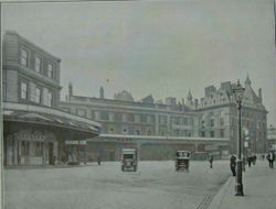
The chaotic nature of the station at the turn of the century was described in John Davidson's poem, ‘’London Bridge’’
- ... Inside the station, everything's so old,
- So inconvenient, of such manifold
- Perplexity, and, as a mole might see,
- So strictly what a station shouldn't be,
- That no idea minifies its crude
- And yet elaborate ineptitude. ...[19]
The LB&SCR electrified the South London Line from London Bridge to Victoria in 1909 using an overhead system. Once this experiment proved to be successful other suburban services from the station were electrified, including the lines to Crystal Palace in 1912.[20] Electrification of the main line to Croydon was not however completed until 1920 due to delays resulting from the First World War.[21]
Southern Railway Station
The grouping of the railways of southern England to form the Southern Railway in 1923 at last brought the two adjoining stations under single ownership. Between 1926 and 1928 the Southern Railway electrified the SE&CR suburban lines at London Bridge using a Third rail electric system, and converted the existing LB&SCR routes to the same system. At the same time it installed colour light signalling. The Southern Railway electrified the Brighton Main Line services to Brighton and the South Coast in 1932/3, so that by 1936 90% of trains at the station were electric.
Both the London Bridge stations were badly damaged by bombing in the London Blitz in December 1940 and early 1941. The shell of the two stations was patched up but the former Terminal Hotel, then used as railway offices, was rendered unsafe and demolished.[22]
British Railways Station
British Railways, which took over responsibility for the station in 1948, continued the electrification of the lines from London Bridge during the 1950s and 1960s. However, by the early 1970s the station could no longer cope with the volume of traffic. Thus between 1972 and 1978, British Rail (as it was then known) undertook a major redevelopment of the station and its approaches.[23]. This included a £21 million re-signalling scheme, and a new station concourse designed by N. D. T. Wikeley, regional architect for British Rail Southern. This was opened 14 December 1978. New awnings were added over the former S.E.R. platforms, but the arched Brighton roof was retained. It has been described as "one of the best modern station reconstructions in Britain."[24]
National Rail
The through platforms, 1-6, are on the north side of the station. Platforms 1-3 are served by trains starting and ending at Cannon Street. Services to and from Charing Cross use platforms 4-6 and a passing loop to the south of platform 6. Platforms 5 & 6 are also served by First Capital Connect with its Thameslink Bedford to Brighton services via Luton, St Albans, St Pancras International, Farringdon, City Thameslink, Blackfriars and Gatwick Airport. Platform 6 is the busiest railway platform in Europe, due to the necessity of routing all trains heading to Charing Cross and Blackfriars through it[25].
The terminal platforms, 8-16, are on the south side of the station and are mostly served by Southern services to south London and the south coast.
 London Bridge exterior |
 London Bridge interior |
 National Rail terminal platforms |
 Through platforms |
Services
| Mainline railways around the South Bank | |||||||||||||||||||||||||||||||||||||||||||||||||||||||||||||||||||||||||||||||||||||||||||||||||||||||||||||||||||||||||||||||||||||||||||||||||||||||||||||||||||||||||||||||||||||||||||||||||
|---|---|---|---|---|---|---|---|---|---|---|---|---|---|---|---|---|---|---|---|---|---|---|---|---|---|---|---|---|---|---|---|---|---|---|---|---|---|---|---|---|---|---|---|---|---|---|---|---|---|---|---|---|---|---|---|---|---|---|---|---|---|---|---|---|---|---|---|---|---|---|---|---|---|---|---|---|---|---|---|---|---|---|---|---|---|---|---|---|---|---|---|---|---|---|---|---|---|---|---|---|---|---|---|---|---|---|---|---|---|---|---|---|---|---|---|---|---|---|---|---|---|---|---|---|---|---|---|---|---|---|---|---|---|---|---|---|---|---|---|---|---|---|---|---|---|---|---|---|---|---|---|---|---|---|---|---|---|---|---|---|---|---|---|---|---|---|---|---|---|---|---|---|---|---|---|---|---|---|---|---|---|---|---|---|---|---|---|---|---|---|---|---|---|
|
|||||||||||||||||||||||||||||||||||||||||||||||||||||||||||||||||||||||||||||||||||||||||||||||||||||||||||||||||||||||||||||||||||||||||||||||||||||||||||||||||||||||||||||||||||||||||||||||||
The typical off-peak service from the station is:
First Capital Connect
- 4tph (trains per hour) to Bedford
- 4tph to Brighton (2tph semi-fast services, 2tph stopping services)
Southeastern
- 16tph to London Charing Cross
- 14tph to London Cannon Street
- 2tph to Dartford via Greenwich
- 2tph to Slade Green via Greenwich
- 2tph to Crayford via Greenwich, continues to Cannon Street via Sidcup
- 2tph to Dartford via Bexleyheath
- 2tph to Barnehurst via Bexleyheath
- 2tph to Hayes via Catford Bridge (fast to Ladywell)
- 2tph to Hayes via Lewisham
- 2tph to Gravesend via Sidcup
- 2tph to Slade Green via Sidcup, continues to Cannon Street via Greenwich
- 2tph to Gillingham via Lewisham and Woolwich Arsenal
- 2tph to Orpington via Lewisham
- 2tph to Sevenoaks via Orpington
- 2tph to Tunbridge Wells via Sevenoaks
- 2tph to Hastings via Tunbridge Wells
- 2tph to Margate / Ramsgate via Canterbury West / Folkestone Central (dividing at Ashford International)
Southern
- 2tph to London Victoria via Peckham Rye
- 2tph to London Victoria via Crystal Palace
- 2tph to West Croydon via Streatham
- 2tph to Sutton via New Cross Gate
- 2tph to Caterham via New Cross Gate
- 2tph to Tattenham Corner
- 2tph to Beckenham Junction via Crystal Palace
- 2tph to Horsham via Redhill
- 1tph to Uckfield via Oxted
- 1tph to Tonbridge via Redhill
- 1tph to Reigate via Redhill
| Preceding station | Following station | |||
|---|---|---|---|---|
| London Blackfriars | First Capital Connect Thameslink |
East Croydon | ||
| London Cannon Street or Waterloo East |
Southeastern South Eastern Main Line |
Sevenoaks / Orpington / Rochester or Chatham (Peak hours only) |
||
| London Cannon Street or Waterloo East |
Southeastern Greenwich Line |
Deptford | ||
| Southeastern South Eastern Main Line |
New Cross or Lewisham or Ladywell or Hither Green |
|||
| Terminus | Southern London Bridge to Tonbridge via East Croydon and Redhill |
Norwood Junction | ||
| Terminus | Southern Brighton Main Line |
Norwood Junction or East Croydon |
||
| Terminus | Southern Tattenham Corner Line |
Norwood Junction or East Croydon |
||
| Terminus | Southern Caterham Line/South London Line (Outer) |
New Cross Gate | ||
| Terminus | Southern South London Line (Inner) |
South Bermondsey | ||
London Underground
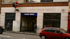 Borough High Street eastern entrance |
|
| Location | The Borough |
|---|---|
| Local authority | Southwark |
| Managed by | London Underground |
| Platforms in use | 4 |
| Accessible | |
| Fare zone | 1 |
|
|
|
| London Underground annual entry and exit | |
| 2004 | |
| 2007 | |
| 2008 | |
|
|
|
| 1900 | Opened by C&SLR |
| 7 October 1999 | Jubilee Line started |
|
|
|
| List of stations | Underground · National Rail |
The Underground station is between Borough and Bank on the Northern Line, and between Southwark and Bermondsey on the Jubilee Line. The station is the sixth busiest on the Underground network and is the only station on the London Underground network with 'London' in its name (while the NR termini are named, for instance 'London Waterloo' the Underground station is simply named 'Waterloo').
Originally Northern Line trains ran to a terminus at King William Street bypassing London Bridge, but the construction of a new station at Bank to provide greater capacity and allow northward extension required a new tunnel alignment, and provided the opportunity for a station at London Bridge. The station entrance was originally at Three Castles House on the corner of London Bridge Street and Station Approach, but has since been moved to Borough High Street and Tooley Street. The Northern Line platforms were rebuilt during the late 1990s to increase the platform and circulation areas in preparation for the opening of the Jubilee Line.
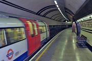
The Northern Line station opened on 25 February 1900 as part of the City & South London Railway's (C&SLR's) revised route from Borough to Bank and Moorgate. The Jubilee Line station opened on 7 October 1999[28] as part of the Jubilee Line Extension, although trains had been running through non-stop from the previous month. To enable the Jubilee Line to be constructed, months of major engineering works to relocate buried services in the surrounding streets had to be undertaken. A new ticket hall was created in the arches under the main-line station, providing improved interchange. During excavations a variety of Roman remains were found, including pottery and fragments of mosaics; some of these are now on display in the station. The Jubilee Line platforms have been fitted with platform edge doors in common with all other stations on the extension.
There are two platforms on each line and two main sets of escalators to and from the Tooley Street ticket hall. All four platforms are directly accessible from the Borough High Street entrance/exit.
Services
| Preceding station | London Underground | Following station | ||
|---|---|---|---|---|
|
Southwark
towards Stanmore
|
Jubilee line |
Bermondsey
towards Stratford
|
||
|
Borough
towards Morden
|
Northern line |
towards Edgware, Mill Hill East
or High Barnet |
River Service/London Bridge City Pier
London River Services London Bridge City Pier on the River Thames is slightly north of the station. It is served by Thames Clipper river boat services to Canary Wharf, Greenwich and the O2 in the east, and Embankment to the west.
| Preceding station | London River Services | Following station | ||
|---|---|---|---|---|
|
Bankside Pier
toward Embankment Pier
|
Commuter Service |
Tower Millennium Pier
toward Woolwich Arsenal Pier
|
Transport links
There is a bus station stituated at the station forecourt.
London bus route 17, 21, 35, 40, 43, 47, 48, 133, 141, 149, 171, 343, 381 and night bus route N21, N35, N47, N133, N171, N343 and N381 serve the station.
Future development
Thameslink renovation
London Bridge station will undergo a major transformation as part of a wider project known as Masterplan to accommodate longer 12-carriage Thameslink programme trains and many other benefits. Three terminus-platforms will be closed and 3 new through-platforms will be created to allow additional services to continue to either Cannon Street, Charing Cross or Thameslink stations north of the River Thames.
A new station concourse will be built to improve circulation; this will require the demolition of brick vaults between Stainer and Weston Streets, which will themselves become part of the new concourse (and therefore cease to be thoroughfares).[29] The space relinquished by the existing concourse will allow Network Rail to expand the adjacent bus station,[30] and new retail facilities will be built into the existing western arcade, which will be re-opened and extended to link the Underground station and Joiner Street.[31]
The bulk of the work taking place after the 2012 Olympic Games. Work and will not expected to be complete until 2015. During this works it is expected that Thameslink trains will be diverted to Herne Hill and will not stop at London Bridge.[32]
Shard London Bridge, which will be one of the tallest skyscrapers in Europe, is being constructed at the southwest corner of the station, near the bus station. As of mid 2010, construction of the tower is well underway with steelwork beginning to rise and the first glass panels being fitted. The shape of the shard (of glass) is becoming visible.
The increase in through platforms will also allow London Bridge to function as an emergency terminus for services approaching the station from the west.[33] To accommodate these alterations, the listed northern wall of the terminus train-shed will be demolished and replaced with a new retaining wall, and the listed bays of the roof over the terminating platform will be dismantled and stored.[34]
Accidents
There have been 36 recorded railway accidents at London Bridge, the earliest on 6 December 1850 and the latest 22 October 1956, but relatively few of these have involved fatalities.[35] The most serious accidents are as follows:
- On 1 February 1884, the 12:05pm London Bridge to Victoria hauled by LBSC Terrier No.71 Wapping collided with a D1 tank which was fouling the exit from the platform. Two carriages derailed.[36]
- On 27 November 1895, a local train hauled by LB&SCR Terrier No. 70 Poplar collided with the buffer stops.[36]
- At 09:30 on 23 January 1948, a train formed of a 6PAN and a 6PUL unit, which had formed that days 08:05 from Seaford and 07:30 from Ore, was allowed to draw up to the inner home signal, where it should have stopped. Instead it overran the signal and collided at a speed of between 15 and 20 mph (24 to 32 km/h) with the empty stock which had formed the 08:20 from Brighton. This train was formed of two 6PAN units. The train that was struck was forced through the buffers and demolished a bookstall. Three people were killed and 34 were injured.[37]
On 8 January 1999, the Spa Road Junction rail crash occurred a short distance outside the station.
Other nearby stations
National Rail
- Cannon Street
- Blackfriars
- London Waterloo
- London Waterloo East
- Elephant & Castle
London Underground
- Borough
- Monument
- Southwark
- Elephant & Castle
- Bermondsey
References
- ↑ "London and South East". Rail Map for People with Reduced Mobility. National Rail. September 2006. http://www.nationalrail.co.uk/system/galleries/download/mobility_maps/LondonSouthEast.pdf. Retrieved 1 January 2010.
- ↑ 2.0 2.1 2.2 2.3 2.4 2.5 "Station usage". Rail statistics. Office of Rail Regulation. 12 March 2009. http://www.rail-reg.gov.uk/server/show/nav.1529. Retrieved 19 January 2010.
- ↑ Turner, J.T. Howard (1977). The London Brighton and South Coast Railway. 1. Origins and formation. London: Batsford. pp. 41–2. ISBN 071340275X.
- ↑ Turner (1977) p.42
- ↑ Turner, (1977) pp.26-39.
- ↑ Turner, (1977) pp.176-9.
- ↑ Ellis, C. Hamilton (19710). The London Brighton and South Coast Railway. Shepperton: Ian Allan. ISBN 0-7110-0269-X. p.223.
- ↑ "A notable station centenary". The Railway Gazette: 966–7. 11 December 1936.
- ↑ Eliis, p.223.
- ↑ Turner, J.T. Howard (1978). The London Brighton and South Coast Railway. 2. Establishment and growth. London: Batsford. pp. 23. ISBN 0713411988.
- ↑ London Railways Track Map for 1870 Establishment and growth. London: Quail Map Company. 1983. pp. 23.
- ↑ Railway Gazette 11 December 1936 p.966
- ↑ Bradley, D.L. (1979). The Locomotive History of the London Chatham and Dover Railway. Railway Correspondence and Travel Society. ISBN 0-901115-47-9. p.6.
- ↑ Bradshaw, George (1861). Bradshaw's monthly railway and steam navigation guide. Bradshaw. p.16.
- ↑ The Times Wednesday, 5 Dec 1860, p.2.
- ↑ 25 & 26 Vic. cap.78 30 June 1862,
- ↑ Turner, (1978) pp.185-93.
- ↑ Heap, Christine and van Riemsdijk, John (1980). The Pre-Grouping Railways part 2.. H.M.S.O. for the Science Museum. ISBN 0-11-290309-6. p.78.
- ↑ Davidson, John (1909). Fleet Street and Other Poems. London.
- ↑ Turner, J.T. Howard (1979). The London Brighton and South Coast Railway. 3. Completion and maturity. London: Batsford. pp. 172–9. ISBN 07134113891.
- ↑ Turner, (1978), pp.206-7.
- ↑ Ellis, p.223.
- ↑ Eddolls, John (1983). The Brighton Line =. Newton Abbott: David & Charles. pp. 31–2. ISBN 0715382519.
- ↑ Jack Simmons and Gordon Bibble, ed (1997). The Oxford companion to British Railway History =. Oxford: Oxford University Press. pp. 291. ISBN 0192116975.
- ↑ "Route Plans 2008 - Route 1: Kent" (PDF). Strategic Rail Plan 2008. Network Rail. April 2008. pp. 7. http://www.networkrail.co.uk/browse%20documents/StrategicBusinessPlan/RoutePlans/2008/Route%201%20-%20Kent.pdf. Retrieved 3 January 2009.
- ↑ "Step free Tube Guide". Transport for London. December 2009. http://www.tfl.gov.uk/assets/downloads/step-free-tube-guide-map.pdf. Retrieved 8 February 2010.
- ↑ 27.0 27.1 27.2 "Customer metrics: entries and exits". London Underground performance update. Transport for London. 2003-2009. http://www.tfl.gov.uk/tfl/corporate/modesoftransport/tube/performance/default.asp?onload=entryexit. Retrieved 22 May 2010.
- ↑ Horne, M: The Jubilee Line, page 80. Capital Transport Publishing, 2000.
- ↑ Network Rail (2005b) - pg.18, paragraph 2.24
- ↑ Network Rail (2005b) - pg.18, paragraph 2.25
- ↑ Network Rail (2005b) - pg.18, paragraph 2.26
- ↑ "London Bridge Station". Thameslink Programme. http://www.thameslinkprogramme.co.uk/cms/pages/view/35. Retrieved 17 December 2009.
- ↑ Network Rail (2005a) - pg.17, paragraph 4.2.4
- ↑ Network Rail (2005b) - pg.18, paragraph 2.27
- ↑ http://www.railwaysarchive.co.uk/eventlisting.php?location=701&page=4&submit=Go
- ↑ 36.0 36.1 Middlemass, Tom (1995). "Chapter 5". Stroudley and his Terriers. York: Pendragon. ISBN 1 899816 00 3.
- ↑ Moody, G. T. (1960) (3rd edition ed.). Hampton Court, Surrey: Ian Allan Ltd.. pp. 138. ISBN.
- Ransom, P. J. G. (1990). The Victorian Railway and How It Evolved. Heinemann.
- Simmons, J. (1995). The Victorian Railways. Thames and Hudson.
External links
- London Transport Museum Photographic Archive
- Station information on London Bridge station from Network Rail
|
|||||||||||||||||||||||||
|
|||||||||||||||||||||||||
|
||||||||||||||||||||||||||||||||||||||||||||||||||
|
|||||||||||||||||

